Description
NEW IN THE BOX – LIMITED QUANTITIES
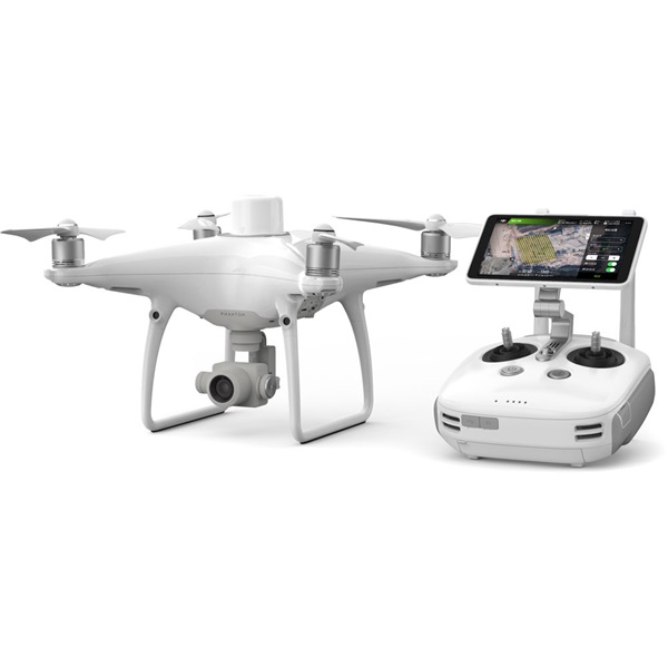
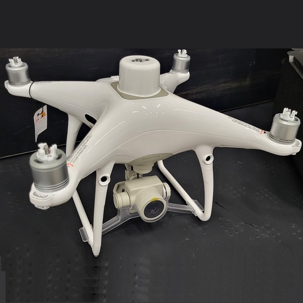
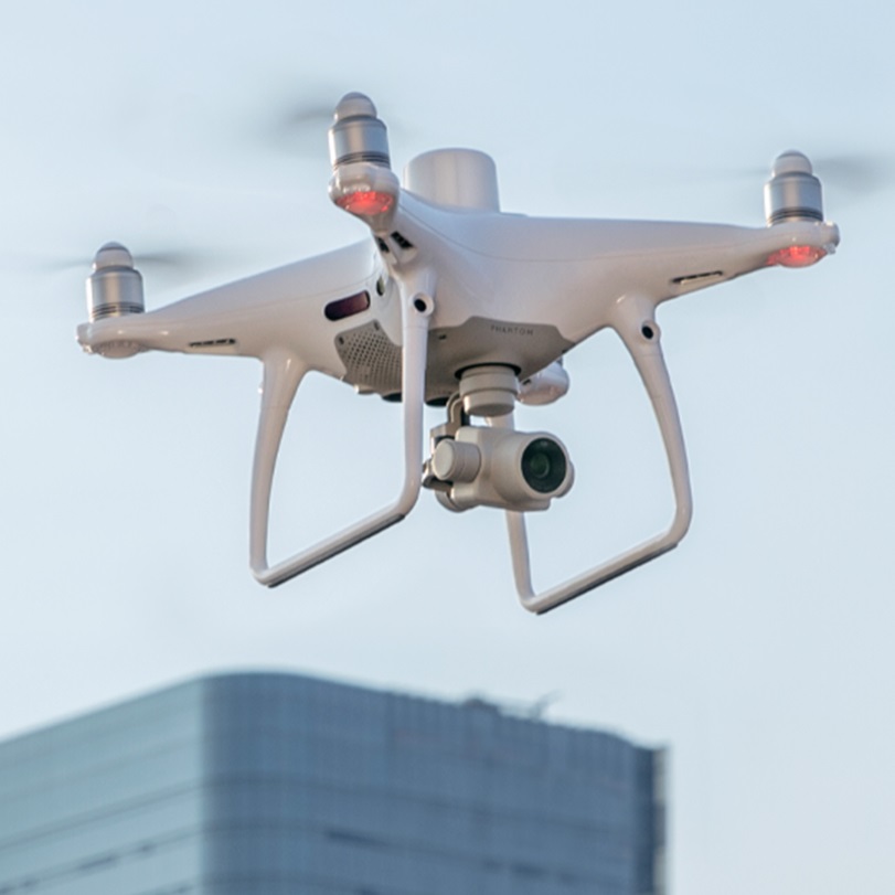
The Phantom 4 RTK Quadcopter from DJI is designed to deliver centimeter-level accurate mapping for surveying, mapping, construction, and inspections. Utilizing an RTK receiver on the top of Phantom 4, the Phantom 4 RTK can achieve 1cm+1ppm RTK horizontal and 1.5cm+1ppm RTK vertical positioning accuracy.
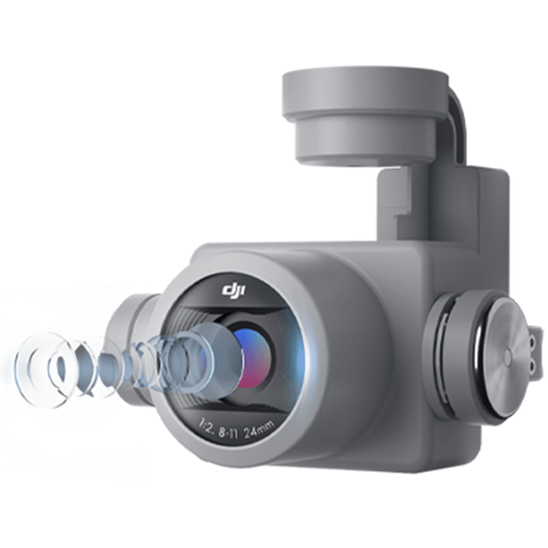
In addition to the RTK receiver, the P4 RTK can achieve this accuracy through DJI’s TimeSync system and the gimbal camera’s calibration process. The camera is the same as a standard Phantom 4, but with the Phantom 4 RTK, each camera has its radial and tangential lens distortions measured. They are added to the metadata of all captured images, allowing for accurate post-processing that accounts for any distortions.
It can perform mapping duties in real time. Pilots can utilize the photogrammetry and waypoint flight modes in the GS RTK app. This gives mapping-specific functionality. These include selecting flight paths and directly loading KML area files. Combine it all and you have an enterprise-level mapping solution that can be used right out of the box.
Max flight time: 30 min
Max transmission range: up to 4.34 miles (7 km)
20-MP 1″ CMOS sensor
Built-in RTK module, supports PPK
Accurate positioning data with TimeSync
Integrated flight planning with GS RTK app
Complete mapping solution when used with DJI Terra
Specifications
PHANTOM 4 RTK SPECS
AIRCRAFT
Takeoff Weight 1391 g
Diagonal Distance 350 mm
Max Service Ceiling Above Sea Level 19685 ft (6000 m)
Max Ascent Speed 6 m/s (automatic flight); 5 m/s (manual control)
Max Descent Speed 3 m/s
Max Speed 31 mph (50 kph)(P-mode)
36 mph (58 kph)(A-mode)
Max Flight Time Approx. 30 minutes
Operating Temperature Range 32° to 104° F (0° to 40℃)
Operating Frequency 2.400 GHz to 2.483 GHz (Europe, Japan, Korea)
5.725 GHz to 5.850 GHz (United States, China)
Transmission Power (EIRP) 2.4 GHz
CECE (Europe) / MIC (Japan) / KCC (Korea) :< 20 dBm
5.8 GHz
SRRC(China) / FCC(United States)/(Taiwan,China):< 26 dBm
Hover Accuracy Range RTK enabled and functioning properly:
Vertical:±0.1 m;Horizontal:±0.1 m
RTK disabled
Vertical:±0.1 m(with vision positioning );
±0.5 m(with GNSS positioning)
Horizontal:±0.3 m(with vision positioning);
±1.5 m(with GNSS positioning)
Image Position Offset The position of the camera center is relative to the phase center of the onboard D-RTK antenna under t
axis:(36, 0, and 192 mm) already applied to the image coordinates in Exif data. The positive x, y, and z ax
body point to the forward, rightward, and downward of the aircraft, respectively.
MAPPING FUNCTIONS
Mapping Accuracy ** Mapping accuracy meets the requirements of the ASPRS Accuracy Standards for Digital Orthophotos C
** The actual accuracy depends on surrounding lighting and patterns, aircraft altitude, mapping software
factors when shooting.
Ground Sample Distance(GSD) (H/36.5) cm/pixel,
H means the aircraft altitude relative to the shooting scene (unit: m)
Data Acquisition Efficiency Max operating area of approx. 1 km² for a single flight(at an altitude of 182 m, i.e., GSD is approx. 5 cm/
requirements of the ASPRS Accuracy Standards for Digital Orthophotos Class Ⅲ
VISION SYSTEM
Velocity Range ≤31 mph(50 kph) at 6.6 ft(2 m) above ground with adequate lighting
Altitude Range 0-33 ft(0 – 10 m)
Operating Range 0-33 ft(0 – 10 m)
Obstacle Sensing Range 2-98 ft(0.7-30 m)
FOV Forward/Rear: 60° (horizontal), ±27° (vertical)
Downward: 70° (front and rear), 50° (left and right)
Measuring Frequency Forward/Rear:10 Hz;
Downward: 20 Hz
Operating Environment Surfaces with clear patterns and adequate lighting(> 15 lux)
CAMERA
Sensor 1″ CMOS; Effective pixels: 20 M
Lens FOV 84°;8.8 mm / 24 mm(35 mm format equivalent:24 mm);
f/2.8 – f/11, auto focus at 1 m – ∞
ISO Range Video:100-3200(Auto)
100-6400(Manual);
Photo:100-3200(Auto)
100-12800(Manual)
Mechanical Shutter Speed 8 – 1/2000 s
Electronic Shutter Speed 8 – 1/8000 s
Max Image Size 4864×3648(4:3);
5472×3648(3:2)
Video Recording Modes H.264,4K:3840×2160 30p
Photo Format JPEG
Video Format MOV
Supported File Systems FAT32(≤ 32 GB);
exFAT(> 32 GB)
Supported SD Cards MicroSD, Max Capacity: 128 GB. Class 10 or UHS-1 rating required Write speed≥15 MB/s
Operating Temperature Range 32° to 104° F (0° to 40℃)
INTELLIGENT FLIGHT BATTERY(PH4-5870MAH-15.2V)
Capacity 5870 mAh
Voltage 15.2 V
Battery Type LiPo 4S
Energy 89.2 Wh
Net Weight 468 g
Charging Temperature Range 14° to 104℉(-10° to 40℃)
Max charging Power 160 W
INTELLIGENT BATTERY CHARING HUB(WCH2)
Input Voltage 17.3 – 26.2 V
Output Voltage and Current 8.7 V,6 A;5 V,2 A
Operating Temperature 41° to 104℉(5° to 40℃)


Reviews
There are no reviews yet.