
Description
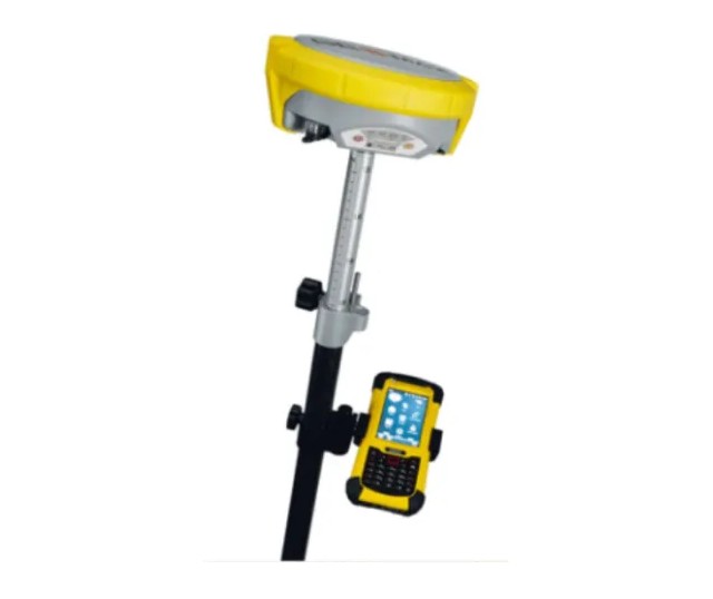
The GeoMax Zenith 15 is a high-performance GNSS receiver designed for geodetic applications, providing reliable and accurate positioning solutions. It is commonly used for surveying, mapping, and other geospatial tasks. Here’s a detailed overview of the GeoMax Zenith 15 Pro GNSS rover and base station:
Key Features of GeoMax Zenith 15:
Satellite Tracking:
- Multi-Constellation Support: Tracks GPS, GLONASS, Galileo, and BeiDou satellites, ensuring high availability and reliability.
- Advanced GNSS Technology: Utilizes advanced signal processing techniques for improved performance in challenging environments.
RTK Positioning:
- High Precision: Achieves centimeter-level accuracy with RTK technology.
- RTK Corrections: Receives corrections from a base station or network RTK services, ensuring real-time high-precision positioning.
Connectivity:
- Bluetooth and Wi-Fi: Facilitates easy data transfer and communication with other devices.
- UHF Radio: For reliable long-range communication between the rover and base station.
- 4G LTE Modem (Optional): Enables remote data access and seamless connectivity to the internet.
Durability:
- Rugged Design: Built to withstand tough field conditions, with an IP68 rating for dust and water resistance.
- Temperature Tolerance: Operates effectively in extreme temperatures, making it suitable for various climates.
Battery Life:
- Long-Lasting Power: Equipped with high-capacity batteries to ensure prolonged field operation.
Data Management:
- Internal Memory: Onboard data storage for logging survey data.
- External Storage Options: Supports external memory cards for additional storage needs.
GeoMax Zenith 15 Base Station:
Key Features:
- High Stability: Provides a stable reference point for RTK corrections, enhancing the accuracy of the rover.
- Wide Range: Offers extended coverage for RTK corrections, suitable for large-scale survey projects.
- Durability: Designed to endure harsh field conditions with robust construction.
Applications:
- Land Surveying: High-precision boundary and topographic surveys.
- Construction: Accurate site layout, excavation, and grading.
- Mapping: Precise data collection for GIS and mapping projects.
- Agriculture: Supports precision farming and land management.
- Infrastructure: Utility mapping and monitoring, ensuring accurate geospatial data.

Reviews
There are no reviews yet.